Arduino with GPS shield and sensors
 Smartphones with GPS cameras
 Pen & paper, or similar mark making tools

PROJECT INTRODUCTION:
Data Walking is an ongoing research project looking at gathering environmental data while walking around, and then visualising the results of those walks, hoping to build a rich picture of that area over time.
We are trying to be creative with how data might be gathered, and we are trying to be creative with how we communicate that data.
It is about trying to expose a designer to data gathering processes, and a scientist to consider new ways of visualising their results; connecting those two sides as one pipeline.
Ultimately it is about participants getting out and engaging with their surroundings.
Data Walking is a research project by David Hunter, funded by the Ravensbourne Research Office.
TECHNOLOGIES:
Arduino with GPS shield and sensors
 Smartphones with GPS cameras
 Pen & paper, or similar mark making tools

PHASES:
London
 Amsterdam
 Taipei
 North Greenwich

PUBLICATION:
Over the summer a printed publication will be put together on the North Greenwich phase of the project.
The publication will have some writing about the genesis of the project, its aims, the context in which it is happening, and some discussion of findings, caveats and limitations. It will also have advice and ideas on creative data gathering and tools to use, as well as data visualisation. And possibly tutorials including code on the data gathering and visualising techniques.
It will also contain data visualisations and graphic responses from students, staff, and visiting designers and studios using the data gathered over the year.
SUBMISSIONS:
Erin Browell, Student
 Brendan Dawes, Designer
 CatalogTree, Studio
 Tom Longmate, Visitng Lecturer

VISUAL REFERENCES:
Phantom Terrain
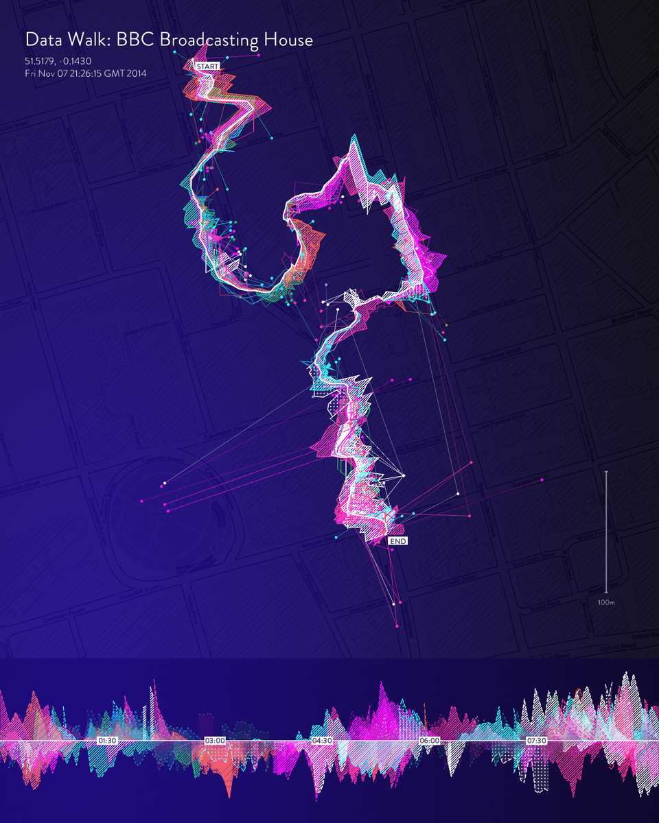 Every Building on the Sunset Strip
 On Broadway
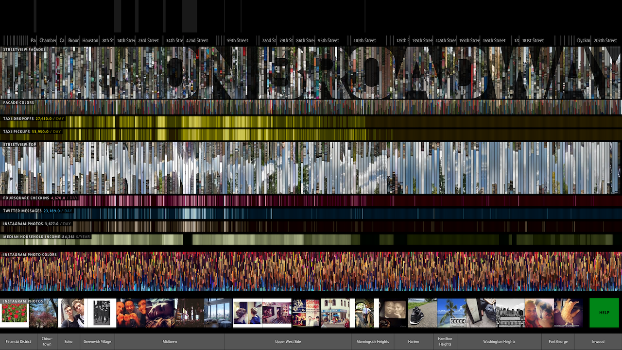 Boyle Family
 Hans Eijkelboom
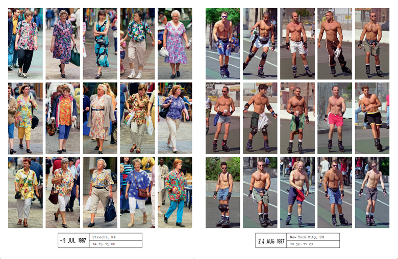
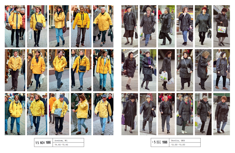
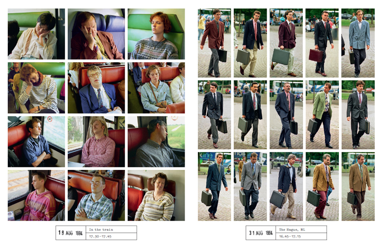
BRIEF: Collections and Reflections
-- What can we learn about a place by not just the quantity of something but the characteristics of that something?
It is not just that there is a lot of litter, but the type of litter that gives us insight into human activity.
-- Through photography we can capture those characteristics.
-- You are required to get into pairs/small teams.
Each pair/team will be responsible for collecting a different sort of information.
-- Team 1: Perspectives
Every 2 minutes take 6 photos to capture the surroundings
1 x up at the sky
1 x down at the ground
1 x to the left
1 x to the right
1 x directly in front
1 x directly behind
-- Team 2: People
Capture the people who you walk past
Please consider the public in performing this task!
-- Team 3: Messages
Capture all the messages with words you walk past, such as:
Signage
Posters
Advertising
Grafitti
-- Team 4: Security
Capture all the security measures you walk past, such as:
CCTV cameras
Locked gates
Personnel
-- Team 5: Litter
Capture all the litter you walk past
Capture all the litter bins you walk past
-- Team 6: Flora
Capture all the plantlife you walk past, such as:
Trees
Bushes
Flowers
Grass
-- Team 7: Fauna
Capture all the animals you walk past, such as:
Birds
Insects
Rodents
Pets
-- After the walk, we will share images, analyse and organise them through LATCH exercises to create collections and visualisations of the walk.
-- Technical tip: it would be fantastic if you switch on location services on your phone, this will store the GPS of each image and help to make maps in future on the project.
-- For anyone without a smartphone, we can provide pen & paper!
ROUTE:
SCHEDULE:
0900: Arrive at workshop
0905: Project introduction and workshop briefing
0920: Get into pairs/teams; establish what to photograph
0930: Walk!
1005: Arrive back at 212, Ravensbourne
1005: Send all photos to gd@rave.ac.uk, use wifi: learnxdesign
1015: Analysis and discussion of collected photos using LATCH
1020: Work in your teams to prepare a collection and present it
1044: Huge thank you, now rush to keynote speaker!
This workshop and its outcomes will be included in the project publication!